How to Extract Geolocation from Image?
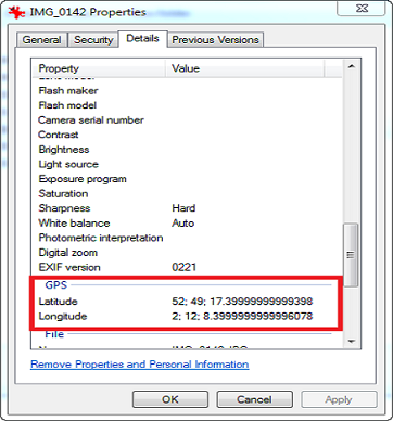
During anemail investigation, the Geolocation image search is the first task followed by the investigators if the evidence contains image attachment within it. But if the mailbox contains a tremendous amount of image data then it is a difficult task to extract the longitude, altitude, and latitude values from each image to find the location. In such situation, MailXaminer is reliable Geolocation forensics software that provides an automated solution to extract GPS location from a photo. Afterscanning and traversing the suspected mailbox using software, investigators are required to proceed with the following steps:
Step 1: Go To Media Section
After adding evidence files into the software, go to the“Media” section that displays all the available media item attachments within the scanned mailbox repository.
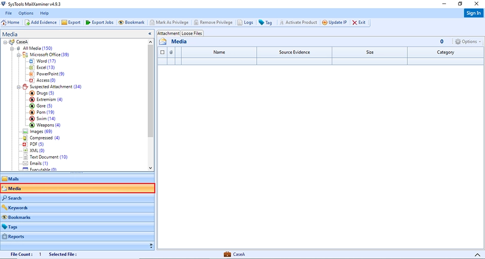
Step 2: List of Media Files
In the “Loose Files” tab, tool displays a complete list all of media data stored in scanned file.Media section allows the categorization of information stored in files according to its file formats.
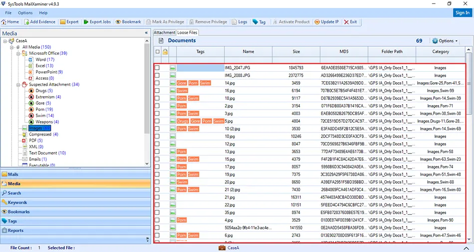
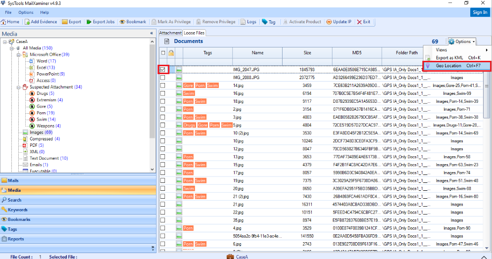
Step 3: Select File to View GPS Location
To view the GPS location of the image, users need to select the desired file. Then, click on "Option" button and select “Geo Location”.
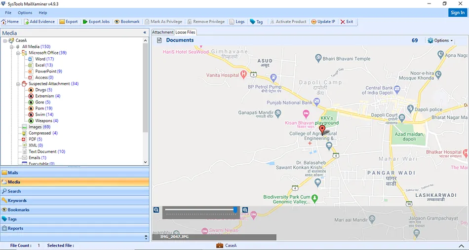
Step 4: View GPS Location in Photos
Now, software will display the GPS location by mapping the location icon at the exact location on the map. A scale is also added at the screen that helps to view image details perfectly. Users can click on "+" to “Zoom In” and "-" sign to "Zoom Out".
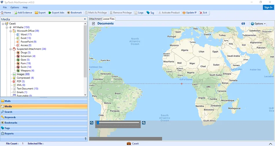
Step 5: Screen with No GPS Data
If no Geotag information data is found in the image, then tool won't display GPS Location.
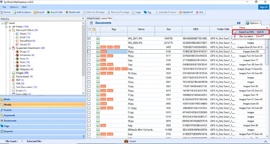
Step 6: Export File in KML
Users can also export the image file into KML format. It helps to extract GPS location from image and viewed on the other application (Google Earth).
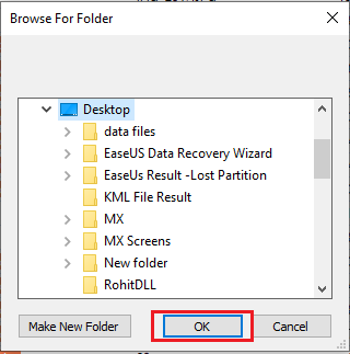
For this, software will ask for the location in your system to save the exported data and evidence will get exported into KML format.
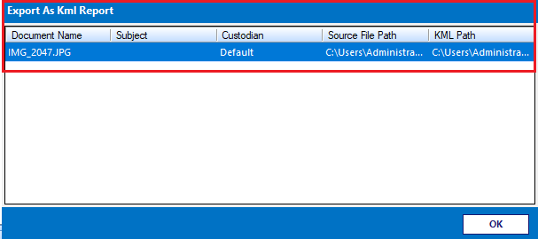
After the evidence gets exported, the software generates an Export Report that can be saved on the local machine. The path of the exported file is will be given in the report.
Step 8: Find Location Using Google Earth
An exported report in KML format can also be used to extract GPS location from the image by using other applicationssuch as Google Earth.
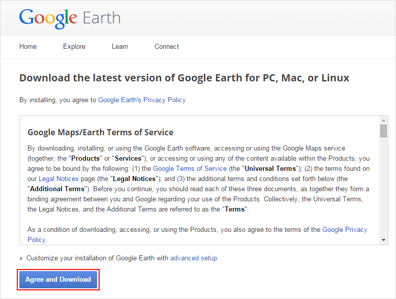
Now for the Geolocation image mapping and manual analysis, the investigator is required to download Google Earth. Forensic examiners can download Google Earth by using the following resource: http://www.google.com/earth/download/ge/agree.html
Step 9: Launch Google Earth
After the downloading and installation of Google earth, launch Google Earth. Then, open the Google Earth user interface.
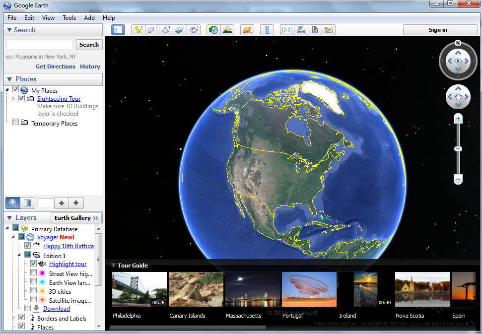
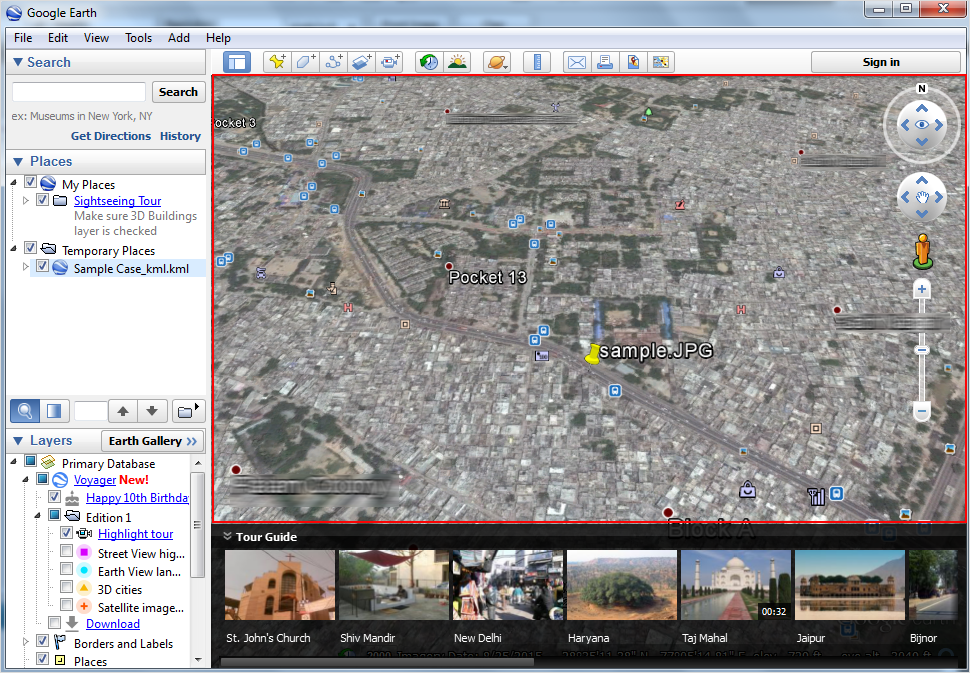
Step 10: Extract Geolocation
Now to extract and view the GPS location from photo, click on “File” option and select “Open”. Then, browse the respective KML file downloaded by MailXaminer. Google Earth immediately read the KML file, then search and maps the Geotag photo location that can be viewed in its window.
To extract Geolocation from image online, investigators can use this Geotag location finder. MailXaminer has been tested and verified by many law enforcement agencies and thus guarantees exact analysis of data without any sort of manipulation within the evidence. Being equipped with extensive features as forensic analysis of videos, pornographic image detection, and many more, the software stands as a complete forensics suite.